Field notes: the subdivision that scored green before a single tree was planted
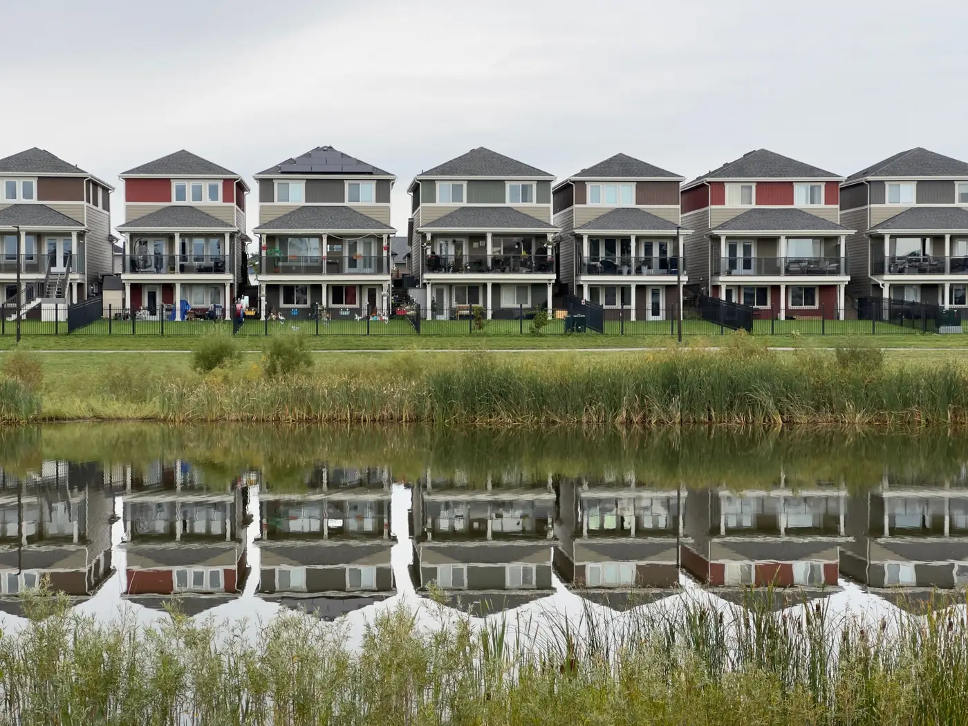
Last month a new listing area crossed my desk with a greenness score that didn't match the aerial sitting right next to it. The imagery showed raw earth, silt fencing, a grid of stub-out driveways, and maybe four saplings staked along the entrance road. The score said the area was greener than two established neighborhoods a mile away with sixty-year oak canopy over every street.
Nobody had fudged the number. The subdivision had just been platted around a stormwater detention basin and a run of HOA-mandated open space along the creek buffer, and open space ratio was doing most of the lifting in whatever composite figure the listing site had licensed. Turf grass over a retention pond reads as open space the same way a shaded street does. It doesn't read as canopy, because there isn't any yet, but the single number out front didn't say which one was carrying it.
This is the thing that trips up anyone scoring greenfield lots: open space and canopy cover are not the same signal, and a developer can deliver a lot of one while delivering almost none of the other for the first five to ten years a subdivision exists. A detention basin, a utility easement left in grass, a pocket park with a slide and no shade structure. All of it counts toward open space under most plat-review definitions. None of it shades a driveway in July.
Buyers scrolling listings don't parse that distinction. They see a green badge or a high number next to the address and assume it means trees, because that's what "green" has always meant to a home shopper. A location-quality figure that can't tell a retention pond from a tree canopy is going to oversell every new-build subdivision in its drainage-heavy phase and undersell the same subdivision once the street trees mature and the detention basin gets mowed less.
The other half of the picture is impervious ratio, and greenfield sites are interesting there too. A freshly graded subdivision often posts a low impervious number at the plat stage, before roofs and driveways go in, then climbs steadily as the build-out finishes. If you're scoring at the wrong point in that curve you get a listing area that looks remarkably permeable for something that's about to be 40% rooftop and asphalt within eighteen months.
None of this means open space is a bad metric. A buffered creek corridor or a genuine neighborhood park is worth knowing about on its own terms: lot adjacency, drainage behavior, whether the HOA keeps it mowed and maintained. It just isn't a stand-in for shade, and treating it as one is how you end up with a scraped-earth subdivision outscoring a tree-lined one that's been there since the Carter administration.
What's held up better on our side is keeping canopy cover, open space, and impervious ratio as separate numbers that roll into one comparable score, rather than blending them into something that hides which component is driving the result. On a greenfield lot that separation is the whole story: it tells you the parcel has open space committed by the plat and near-zero canopy today, and it tells a listing team which of those two facts is going to change on the next imagery pass and which one won't move for a decade. That's the layer our scoring is built around at Greenness Scoring, and it's worth a look if your composite numbers have ever told you a construction site is greener than an oak-lined street.